Geographical flight restrictions
There are areas in Switzerland in which flying drones is prohibited or restricted. Drone pilots must find out about the applicable flight restrictions before each flight.
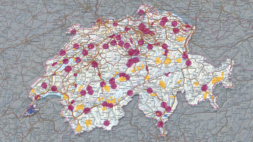
National and cantonal flight restrictions
The content of the interactive drone map is constantly modified and must therefore be consulted before each flight. The drone map shows the national and cantonal flight restriction areas.

Drone pilots must contact the competent authority to obtain permission to fly their drone in an area with flight restrictions. The competent authority, along with further information, is displayed by clicking on the respective area on the map. Further information can also be found below.
Daily Airspace Bulletin Switzerland (DABS)

A map of Switzerland showing the main civil aviation reports is published daily on the DABS website. Drone operators must respect any DABS restrictions that affect their planned drone flight. They should therefore consult DABS before each flight.
DABS is updated several times throughout the day. The version for the following day is published daily at 4pm.
Areas with heightened risk of collision
To avoid dangerous proximity to or even collision with other airspace users, particular caution must be exercised when operating drones near to the following areas:
- Heliports at hospitals and medical facilities
- Mountain landing sites
- Danger zones around published shooting ranges used by the Swiss Armed Forces
- Areas in which paragliders, hang-gliders and gliders fly
The areas mentioned above can be seen on the following map and the website of the Swiss Hang Gliding Association.
Where is flying permitted?
Further information
Index
Federal Office of Civil Aviation FOCA
Unmanned Aircraft Systems UAS